
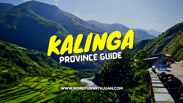

All you need to know about the Province of Kalinga.
Kalinga is a landlocked province in the Philippines situated within the Cordillera Administrative Region in Luzon. Its capital is Tabuk and borders Mountain Province to the south, Abra to the west, Isabela to the east, Cagayan to the northeast, and Apayao to the north.
 |
| Kalinga Province in the Philippines |
Kalinga and Apayao are the result of the 1995 partitioning of the former province of Kalinga-Apayao which was seen to better service the respective needs of the various indigenous peoples in the area. Kalinga is a tribal community in the heart of the Cordillera region.
Loading...
For Your Trip to Kalinga
How much does it cost to visit Kalinga? Click below to compare rates and discounts online:
Homestay / Accommodation
Tours & Activities
Essentials
Popular booked by other travelers
KALINGA IN DETAILS

The following are a few useful and interesting details about this province:
- Location: 17°45′N 121°15′E | View Map
- Year Founded: 1995
- Capital: Tabuk
- Area: 3,231.25 km2 (1,247.59 sq mi)
- Population: 229,600
- Density: 66/km2 (170/sq mi)
- Division: Luzon
- Region: CAR
- Cities & Towns: 1 Component city, 7 Towns (Municipalities)
- Demonym(s): Kalingan
- Elevation: (Mount Binuluan) 2,329 m (7,641 ft)
- Time Zone: PST (UTC+8)
- Zip Code: 3800–3808
- Area code: +63 -(074)-XXX-XXXX
- Electricity: Standard voltage is 220V. Plug commonly used is Type A but Types B and C are used as well.
- Currency: Philippine Peso (PHP)
- Exchange Rate: Approximately 1 USD = 50 PHP | click for exact exchange rate
- Income Class: Third Class
- Religion(s): Indigenous, Roman Catholic
- Language(s): Kalinga, Ilocano, Gaddang, Tagalog, English
- Known For: traditional tattoo, rice, and coffee
- Major Industries: Agriculture (rice, coffee, root crops)
- Climate: Tropical
- Best Time to Visit: December to May
- Clothing: Casual light clothing: shorts, t-shirt, sandals. Light jacket and pants at night, at higher elevations, and boating.
- Airport(s): None
- Seaport(s): None
 |
| Kalinga Provincial Capitol located at Capitol Hills, Tabuk, Kalinga in 2022 |
Before traveling, you might want to check the live weather forecast and updates to make your trip even easier and safer for you. You can also get the latest report for land traffic in Metro Manila and major parts of the Philippines.
WHAT TO PACK FOR KALINGA
Here are some things you might consider bringing with you for your day tour / adventure:
- Stylish face mask
- Water container/tumbler to rehydrate
- Sunscreen for skin protection
- Goggles for swimming or snorkeling
- Stylish Swimsuit
- Travel backpack / luggage
- Reusable vacuum storage packs
- Selfie stick
- Waterproof phone case
- Acion cam
- Camping tent
- WiFi kit
- Power bank
Shopee is my go-to app for things I needed like the ones above. If you'd like discounts and vouchers, you may get the best offers here:

Kalinga History
Kalinga was taken from Cagayan and Isabela provinces and established by the Americans through Philippine Commission Act No. 1642 on May 9, 1907 as a sub-province of Lepanto-Bontoc.
Kalinga was later organized as one of the sub-provinces of Mountain Province, created by Act No. 1876.
In the early years, the subprovince underwent series of territorial changes. Part of Kalinga was transferred to another sub-province Bontoc through Executive Order No. 53 in 1914. In the municipal district of Pinukpuk, barrios were moved to Balbalan in 1926; as well as parts of it to Conner in Apayao in 1927.
Kalinga was became part of a province along with Apayao when the old Mountain Province was divided into four separate provinces through Republic Act No. 4695 in 1966 and, with Abra, became part of the territories in the Cordillera Administrative Region which was created through Executive Order No. 220 in 1987.
Kalinga was converted into a province in 1995 by virtue of RA No. 7878 when majority of the voters in Kalinga-Apayao approved in a plebiscite the division of the province into two.
Etymology
The province's name is derived from the Ibanag and Gaddang noun "kalinga", which means "enemy", "fighter", or "headtaker".
Kalinga Geography
Kalinga covers a total area of 3,231.25 square kilometres (1,247.59 sq mi) occupying the central section of the Cordillera Administrative Region in Luzon. The province is bordered by Mountain Province to the south, Abra to the west, Isabela to the east, Cagayan to the northeast, and Apayao to the north.
Large swaths of the province's lowlands are open grassland suitable for pasture, while the highlands have extensive areas of tropical rainforest. In higher elevations to the west, particularly in the mountains of Balbalan, lie some of the most intact pine forests of Luzon island. Rizal and Tabuk with their flatlands are the biggest rice producers. Next in rice production are the mountainous area, and of note are the rice terraces of Balbalan, Lubuagan, Pasil, Pinukpuk, Tinglayan, and Tanudan.
Kalinga comprises one component city and seven municipalities, all encompassed by a single legislative district.
 |
| Political division of Kalinga |
Tabuk was proclaimed a component city in 2007, but in November 2008 the Supreme Court of the Philippines ruled that its cityhood was unconstitutional. However, Tabuk had its city status reinstated by the Supreme Court on December 22, 2009.
- Balbalan
- Lubuagan
- Pasil
- Pinukpuk
- Rizal
- Tabuk (capital and component city)
- Tanudan
- Tinglayan

Kalinga Climate
The climate in this province experiences an average temperature ranging from 17 to 22 °C (63 to 72 °F) with Type 3 weather patterns. The dry season extends from November to April, while the rest of the year is considered the rainy season, the heaviest rains usually occurring from July to October.
It is best to visit the province during dry season which begins on December and lasts until May.
The most appropriate clothing in this province is casual light clothing: shorts, t-shirt, sandals. Light jacket and pants at night, at higher elevations, and boating.
TOURIST SPOTS TO SEE IN KALINGA
The following is a list of points of interest relating to the Kalinga province:
- Aciga Tree
- Aguinaldo Hill
- Balbalasang National Park
- Buaya Caves
- Cadamayan Falls
- Lubo Rice Terraces
- Mini Museum of Kalinga
- Palan-ah Falls
- Ryan & Sons Winery
- Sungang ViewPoint
- Tinglayan Rice Terraces
- Tiwod Spring
- Tongango Caves
- Tuga Catholic Church
- Ugid Maling Subterranean River
 |
| Cadamayan Falls in Uma, Lubuagan, Kalinga |
 |
| Sungang View Point |
Kalinga Culture
There are many sub-tribes in the province. The strong sense of tribal membership and filial loyalty results in frequent tribal unrest and occasional outright war. Due to the mountainous terrain and warrior-culture of the people, the Kalinga were able to preserve their culture despite centuries of occupation in the lowlands by the Spaniards, Americans, and the Japanese.
 |
| Digdiga Ni Tupayya in Kalinga |
On February 22, 2019, the Department of Tourism announced the bid of Digdiga Ni Tupayya, a Kalinga courtship dance, to be included in the UNESCO Intangible Cultural Heritage Lists.
Kalinga Famous & Historic Figures
- Macli-ing Dulag - a Kalinga warrior and leader (pangat) who opposed the Chico River Dam Project. Murdered by military personnel under the command of dictator Ferdinand Marcos. Dulag's death is remembered as one of the two occasions for the declaration of Cordillera Day in the entire Cordillera Administrative Region. His name has been inscribed in the heroes' marker in Quezon City.
- Conrado Balweg - a former Filipino Catholic priest and rebel who was the founder of the Cordillera People's Liberation Army, a militant group which advocated autonomy for the Cordillera region in the Philippines. He was also known by the nom-de-guerre Ka Ambo.
- Whang-od - a Kalinga master tattooist (mambabatok) and recipient of the prestigious Dangal ng Haraya Award.
- Alonzo Saclag - Awarded as a National Living Treasure for his efforts to preserve the culture of Kalinga through performing arts.
 |
| 105-year old Apo Whang Od, the embodiment of Kalinga tattoo artistry |
ATTRACTIONS TO SEE IN MANILA
Klook.comHOW TO GET TO KALINGA
There's only a few ways getting to Kalinga. Since the province is landlocked, it has no seaport and even an airport. The only way is getting via land travel. Getting to Tabuk from Manila will take at least 10 hours to drive (sometimes take up to 12 hours). It might take longer if you plan to take public commute.
Manila to Tabuk by Bus (direct trip via Tuguegarao route)
There's only one bus company I know that has direct trip from Manila to Tabuk in Kalinga. Victory Liner offers trip from Kamias or Earnshaw Sampaloc terminal to Tabuk.
Another option is to take a bus to Tuguegarao from Pasay, Kamias, or Earnshaw Sampaloc and take a jeepney to Tabuk.
Another bus company that offers direct trip from Manila to Tabuk is GV Florida. They have 1 bus trip on a daily basis back-and-forth Manila and Tabuk via Roxas in Cagayan.
Manila to Bontoc to Tabuk
Second option will be a bus trip from Manila to Bontoc (via Coda Lines) then take a jeepney ride from Bontoc (town proper) going to Tabuk in Kalinga.
Baguio to Bontoc to Tabuk
The most famous way to commute to Kalinga is by taking a bus from Baguio to Bontoc. Then, take a jeepney ride from Bontoc (town proper) going to Tabuk in Kalinga. Get off at Bugnay Village to start your adventure.
Baguio to Bontoc to Buscalan
For those who plans to visit Apo Whang-od, you take a jeepney ride from Bontoc en route to Buscalan Village. Travel time is about 2 hours.
Driving from Manila to Kalinga
For those who are bringing own vehicle to Kalinga, you can follow directions from Waze or Google Maps. However, expect bumpy and rough roads along the way. There's also limited space for parking. So think twice.
ACTIVITIES AND TOURS IN MANILA
FESTIVALS IN KALINGA
The following is a list of festivals celebrated in Kalinga throughout the year:
- Ullalim Festival (Middle of February) – Tabuk City
Frequently Asked Questions (FAQs) About Kalinga
The following are the most frequently asked questions about the Kalinga province.
- Where in the Philippines is Kalinga located?
Kalinga is located on the central section of the Cordillera Administrative Region in Luzon. - Is Kalinga a city or province?
Kalinga is a province. - What is the Capital of Kalinga?
The capital of Kalinga is Tabuk. - What is Kalinga famous for?
Kalinga is famous for traditional tattoo, rice, and coffee.
OTHER PROVINCES IN CAR
kalinga, philippines kalinga tribe kalinga people kalinga religion kalinga province kalinga population kalinga region kalinga culture


&p[summary]=All you need to know about the Province of Kalinga. Kalinga is a landlocked province in the Philippines situated within the ...&p[url]=https://www.morefunwithjuan.com/2022/06/kalinga-province-guide.html&p[images][0]=https://blogger.googleusercontent.com/img/b/R29vZ2xl/AVvXsEgZJTNDINn2MidY8mrko_sj7DSeEmdi6Wn3DHw0T5JsLX_QcWyJEx3GvK8jNasvK24sV0DPu-gktD5QT6shMvZ0fcINV2sc0hxcuJgAkyjdVzQeTYC5JdLBWWSNwRX-P3HKQB0vKHDA4D2KTYEW_t1dRTPA9CdfIACM1vvSM6HvWllOaquuLtbGRNmj/w640-h360/kalinga-province-guide.png)
No comments
Let us know your thoughts!