
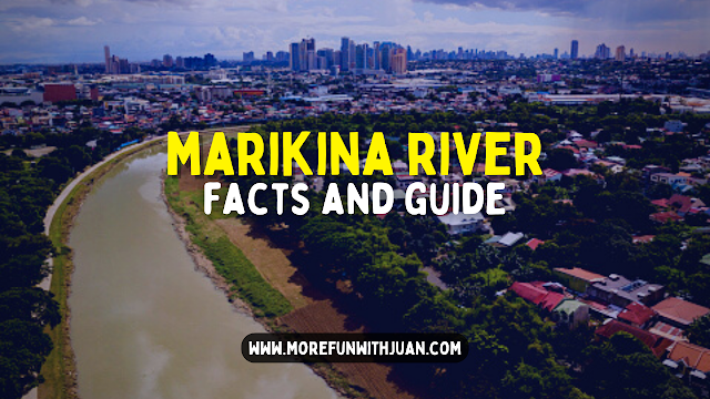

This is your comprehensive guide for the Marikina River.
The Marikina River (Tagalog: Ilog Marikina) is a river in eastern Metro Manila, Philippines. It is the largest tributary of the Pasig River, with headwaters located in the Sierra Madre Mountains in Rodriguez, Rizal province.
Loading...
The Marikina River used to be an important transport route during the Spanish colonial era, but its importance as a transport route diminished when the Philippines' national highway system became more established.
 |
| Marikina River on Google Maps |
The resulting lack of river boat traffic and the deforestation of the upland areas in what is now the Upper Marikina River Basin Protected Landscape contributed to the river's siltation, further reducing its value as a transport route.
Due to negligence and industrial development, the river has become very polluted, an act which recent Marikina administrations have attempted to address.

Marikina River Basin
Area: 698.26 sq. km.
Region: III, IV-A, NCR
Provinces: Rizal, Bulacan
Towns/Cities: 15
Barangays: 197
Outlet: Pasig River further drains into Manila
Est. Pop’n: 7,503,671 (2010)
RBO: Protected Area Management Board Upper Marikina River Basin Protected Landscape
RDC Reso.: RDC Resolution No. 4A-35-2015
Forestland: 325.59 sq. km.
A&D: 372.67 sq. km.
NGP Area: 136.13 sq. km. (as of October, 2015)
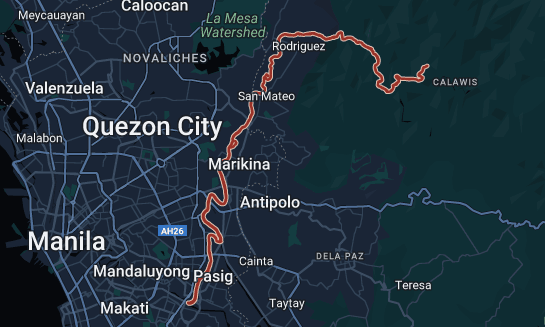
The Marikina River system
In the Pamitinan Protected Landscape located in Sitio Wawa, Brgy. San Rafael, in Rodriguez, the Marikina River is dammed by Wawa Dam, a structure built during the early 1900s to provide water for Manila.
 |
| The drainage basin of the Pasig-Marikina River. Legend: Thick blue line: Pasig River Cyan line: Manggahan Floodway. |
From Rodriguez, the river flows through San Mateo then to its namesake city of Marikina. In Pasig, the river meets the gates of the Manggahan Floodway, a controlled waterway used to prevent flooding in Manila during heavy rains by diverting most of the water of the Marikina toward Laguna de Bay instead of the Pasig River. Located 6.75 kilometres (4.19 mi) downstream is the confluence of the Marikina and Pasig Rivers.
The river's depth ranges from 3 to 21 metres (9.8 to 68.9 ft) and spans from 70 to 120 metres (230 to 390 ft). It has a total area of nearly 75.2 hectares (0.752 km2) and is 27 kilometres (17 mi) long. The riverbank has an elevation of 8 meters above sea level at the boundary of San Mateo and Marikina. This slowly goes down at an elevation of 4 metres (13 ft) nearly before the Malanday and Santo Niño boundary. The lowest elevation is along Calumpang which 2 metres (6 ft 7 in) above sea level.
Tributary waterways
The Marikina River has a number of tributaries in the form of creeks and rivers, and at least one former river-section in Marikina's Barangay Tumana from which the original flow of the river has been diverted. These tributaries drain four municipalities and one city in the province of Rizal, and three cities in the Philippines' National Capital Region.
Rodriguez, Rizal
The biggest of these tributaries are upstream in the more mountainous areas of Rodriguez. This includes the Tayabasan River and Montalban River, the Boso Boso River, and the Wawa River, which meets the Marikina River just upstream of Wawa Dam. Further downstream from the dam, but still in the town of Rodriguez are the Puray River (which flows near Avilon Zoo) and Manga River.
Barangka
Until this point the river follows a more or less east–west direction until San Jose, Rodriguez, where it takes a sharp north–south turn towards the municipality of San Mateo, where the Ampid River forms the boundary between Barangays Maly and Ampid. At this point across the river in Quezon City, Calamiong Creek drains Barangay Bagong Silang. Further downstream the Nangka River and its own tributary in the Sapang Labo Creek mark the boundary between San Mateo and Marikina.

City of Marikina
Somewhere north of Brgy. Tumana in Marikina marks a point at which an American Colonial Era levee shifted the flow of Marikina River west, away from the population center of Sitio Bayanbayanan (now known as Concepcion Uno), where erosion had been a problem. The construction of a levee left behind a remnant waterway now known as Patay na Ilog (literally "Dead River", referring to the former path of the river) where the original path of the river once traversed, which rejoins the Marikina River just south of Tumana Bridge. The dredging for this American era levee left behind a large stone outcropping just below water level where the Marikina's children would play, back when the water was still clean, such that this part of the river is still called luksong kabayo.
The name of Barangay Tumana refers to the Tagalog word for a wide level land just above water level. The area was considered ideal for vegetable farming due to the rich riversoil, and the annual inundation of the area by the Marikina River during the rainy season, which prevented crawling insect pests from staying permanently. This area was eventually also used for riversoil quarrying and saw an influx of informal settlers which turned it into a residential area, eventually becoming a separate barangay from Concepcion, with Patay na Ilog forming part of the boundary.
ATTRACTIONS TO SEE IN MANILA
Klook.comFurther south on the Quezon City side Barangay Pansol is drained by Pansol Creek, with headwaters reaching as far up to just behind the University of the Philippines Integrated School campus. Even further south in Barangay Malanday, Marikina, the Lamuan-Bulelak creek also empties into the Marikina River, although its precise mouth area has been blurred by the construction of residential buildings.
 |
| Marikina River |
Adjacent Creeks
In Marikina, numerous other creeks flow nearby the Marikina River but are not directly connected. These include the Bankaan Creek in Barangay Parang, the Concepcion Creek in Barangay Concepcion Dos, and the Usiw Creek in Barangay Santa Elena. Instead, these waterways are linked in a complex network with the Balanti, Halang, and Muntingdilao Creeks and the Sapang Baho River, eventually emptying into the Manggahan Floodway and Laguna de Bay.
ACTIVITIES AND TOURS IN MANILA
ATTRACTIONS AND TRAVEL DESTINATIONS NEAR MARIKINA RIVER
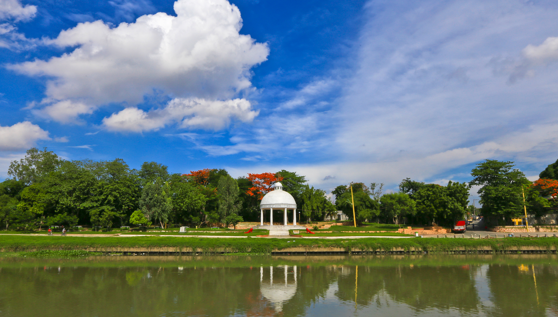
Marikina River Park
The Marikina River Park is a system of parks, trails, open spaces and recreation facilities along an 11-kilometer (6.8 mi) stretch of the Marikina River in Marikina, eastern Metro Manila, Philippines. The urban riverside park covers an area of 220 hectares (540 acres) running through the villages of Santo Niño, Santa Elena, Jesus de la Peña, San Roque, Calumpang, Barangka and Industrial Valley Complex in the western part of the city.
 |
| Roman Garden at Marikina River Park |
The park, under development since 1993, is the city's biggest recreational and sports area containing the Riverbanks Center, a mall and office complex, and the biggest roller skating rink in the Philippines. Marikina River Park is a popular area for camping, jogging, biking and other outdoor activities not just for Marikina residents but also for those from nearby cities in Metro Manila.
 |
| Marikina Riverbanks |
Riverbanks Center
Riverbanks Center (also known as Marikina Riverbanks/Marikina Riverbanks Center or simply Riverbanks) is an integrated development complex for shopping, recreational, business and commercial along Andres Bonifacio Avenue adjacent to Marikina River in Barangka, Marikina, Metro Manila, Philippines.
 |
| Riverbanks Center |
It is home of the Philippine's biggest outdoor amphitheater and outlet center, and the location of once the world's largest pair of shoes.
WHERE TO STAY IN MARIKINA
Here's a list of hotel and accommodation in and nearby Marikina City:
- Hotel Mango - Check Photos, Rates and Availability!
- Sans Hotel at Algers Suites Marikina - Check Photos, Rates and Availability!
- Red Mango Suites - Check Photos, Rates and Availability!
- Ddd Habitat Marikina Hotel - Check Photos, Rates and Availability!
ALSO IN MARIKINA
- 5 Reasons Why You Consider Living In Marikina City
- Marikina Festivals and Events to Attend and Celebrate
- RIVERBANKS CENTER: Marikina City Guide to the Largest Outdoor Amphitheater and Outlet Center
- What to see and do at Marikina Riverbanks Center (ChristmasSaya Carnival 2022)
- List of Watsons Branches in Marikina (with Store Hours & Contact Details)
- List of Palawan Pawnshop Branches (Pera Padala) in Marikina City

WHERE TO STAY IN MARIKINA:
Marikina Hotels & Resorts | Marikina Condos for Rent
IMFWJ IS NOW ON YOUTUBE!
Click here to subscribe to our YouTube Channel.
Marikina Hotels & Resorts | Marikina Condos for Rent
IMFWJ IS NOW ON YOUTUBE!
Click here to subscribe to our YouTube Channel.
Image of Marikina River map Marikina River map Image of Marikina River drawing Marikina River drawing Feedback marikina river bank marikina river cctv live marikina river live marikina river park marikina river water level today marikina river location


&p[summary]=This is your comprehensive guide for the Marikina River. The Marikina River (Tagalog: Ilog Marikina) is a river in eastern Me...&p[url]=https://www.morefunwithjuan.com/2022/06/marikina-river.html&p[images][0]=https://blogger.googleusercontent.com/img/b/R29vZ2xl/AVvXsEjiqLug6m7KzqznNdWAVglKqBBvsP0XnkfPuXuVmnhQ-wWoWurWzfypsLs4SOhxeBlJvYqf8mLibq78WfrlUMnXabnUywI79tv-RplKT6yqhelRPcV67xgoRcTbllr30psme21bdeb3lCP1cwC8_TmTL2DrLwfXyPXx22PMLEOMiLjhloZ_72pGRNYU/w640-h360/marikina%20river%20guide%20and%20facts.png)
No comments
Let us know your thoughts!