Showing posts sorted by relevance for query River. Sort by date Show all posts
Image of Marikina River map Marikina River map Image of Marikina River drawing Marikina River drawing Feedback marikina river bank marikina river cctv live marikina river live marikina river park marikina river water level today marikina river location

This is your comprehensive guide for the Marikina River.


The Marikina River (Tagalog: Ilog Marikina) is a river in eastern Metro Manila, Philippines. It is the largest tributary of the Pasig River, with headwaters located in the Sierra Madre Mountains in Rodriguez, Rizal province.

Loading...

The Marikina River used to be an important transport route during the Spanish colonial era, but its importance as a transport route diminished when the Philippines' national highway system became more established.
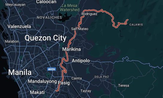
Marikina River on Google Maps

The resulting lack of river boat traffic and the deforestation of the upland areas in what is now the Upper Marikina River Basin Protected Landscape contributed to the river's siltation, further reducing its value as a transport route.

Due to negligence and industrial development, the river has become very polluted, an act which recent Marikina administrations have attempted to address.


Marikina River Basin

Area: 698.26 sq. km.
Region: III, IV-A, NCR
Provinces: Rizal, Bulacan
Towns/Cities: 15
Barangays: 197
Outlet: Pasig River further drains into Manila
Est. Pop’n: 7,503,671 (2010)
RBO: Protected Area Management Board Upper Marikina River Basin Protected Landscape
RDC Reso.: RDC Resolution No. 4A-35-2015
Forestland: 325.59 sq. km.
A&D: 372.67 sq. km.
NGP Area: 136.13 sq. km. (as of October, 2015)


The Marikina River system

In the Pamitinan Protected Landscape located in Sitio Wawa, Brgy. San Rafael, in Rodriguez, the Marikina River is dammed by Wawa Dam, a structure built during the early 1900s to provide water for Manila.

The drainage basin of the Pasig-Marikina River. Legend: Thick blue line: Pasig River Cyan line: Manggahan Floodway.

From Rodriguez, the river flows through San Mateo then to its namesake city of Marikina. In Pasig, the river meets the gates of the Manggahan Floodway, a controlled waterway used to prevent flooding in Manila during heavy rains by diverting most of the water of the Marikina toward Laguna de Bay instead of the Pasig River. Located 6.75 kilometres (4.19 mi) downstream is the confluence of the Marikina and Pasig Rivers.

The river's depth ranges from 3 to 21 metres (9.8 to 68.9 ft) and spans from 70 to 120 metres (230 to 390 ft). It has a total area of nearly 75.2 hectares (0.752 km2) and is 27 kilometres (17 mi) long. The riverbank has an elevation of 8 meters above sea level at the boundary of San Mateo and Marikina. This slowly goes down at an elevation of 4 metres (13 ft) nearly before the Malanday and Santo NiƱo boundary. The lowest elevation is along Calumpang which 2 metres (6 ft 7 in) above sea level.


Tributary waterways

The Marikina River has a number of tributaries in the form of creeks and rivers, and at least one former river-section in Marikina's Barangay Tumana from which the original flow of the river has been diverted. These tributaries drain four municipalities and one city in the province of Rizal, and three cities in the Philippines' National Capital Region.


Rodriguez, Rizal

The biggest of these tributaries are upstream in the more mountainous areas of Rodriguez. This includes the Tayabasan River and Montalban River, the Boso Boso River, and the Wawa River, which meets the Marikina River just upstream of Wawa Dam. Further downstream from the dam, but still in the town of Rodriguez are the Puray River (which flows near Avilon Zoo) and Manga River.


Barangka

Until this point the river follows a more or less east–west direction until San Jose, Rodriguez, where it takes a sharp north–south turn towards the municipality of San Mateo, where the Ampid River forms the boundary between Barangays Maly and Ampid. At this point across the river in Quezon City, Calamiong Creek drains Barangay Bagong Silang. Further downstream the Nangka River and its own tributary in the Sapang Labo Creek mark the boundary between San Mateo and Marikina.

Cheapest Flights and Airline Tickets Online Booking

City of Marikina

Somewhere north of Brgy. Tumana in Marikina marks a point at which an American Colonial Era levee shifted the flow of Marikina River west, away from the population center of Sitio Bayanbayanan (now known as Concepcion Uno), where erosion had been a problem. The construction of a levee left behind a remnant waterway now known as Patay na Ilog (literally "Dead River", referring to the former path of the river) where the original path of the river once traversed, which rejoins the Marikina River just south of Tumana Bridge. The dredging for this American era levee left behind a large stone outcropping just below water level where the Marikina's children would play, back when the water was still clean, such that this part of the river is still called luksong kabayo.


The name of Barangay Tumana refers to the Tagalog word for a wide level land just above water level. The area was considered ideal for vegetable farming due to the rich riversoil, and the annual inundation of the area by the Marikina River during the rainy season, which prevented crawling insect pests from staying permanently. This area was eventually also used for riversoil quarrying and saw an influx of informal settlers which turned it into a residential area, eventually becoming a separate barangay from Concepcion, with Patay na Ilog forming part of the boundary.


ATTRACTIONS TO SEE IN MANILA 

Klook.com

Further south on the Quezon City side Barangay Pansol is drained by Pansol Creek, with headwaters reaching as far up to just behind the University of the Philippines Integrated School campus. Even further south in Barangay Malanday, Marikina, the Lamuan-Bulelak creek also empties into the Marikina River, although its precise mouth area has been blurred by the construction of residential buildings.

Marikina River

Adjacent Creeks

In Marikina, numerous other creeks flow nearby the Marikina River but are not directly connected. These include the Bankaan Creek in Barangay Parang, the Concepcion Creek in Barangay Concepcion Dos, and the Usiw Creek in Barangay Santa Elena. Instead, these waterways are linked in a complex network with the Balanti, Halang, and Muntingdilao Creeks and the Sapang Baho River, eventually emptying into the Manggahan Floodway and Laguna de Bay.


ACTIVITIES AND TOURS IN MANILA


ATTRACTIONS AND TRAVEL DESTINATIONS NEAR MARIKINA RIVER


Marikina River Park

The Marikina River Park is a system of parks, trails, open spaces and recreation facilities along an 11-kilometer (6.8 mi) stretch of the Marikina River in Marikina, eastern Metro Manila, Philippines. The urban riverside park covers an area of 220 hectares (540 acres) running through the villages of Santo NiƱo, Santa Elena, Jesus de la PeƱa, San Roque, Calumpang, Barangka and Industrial Valley Complex in the western part of the city.
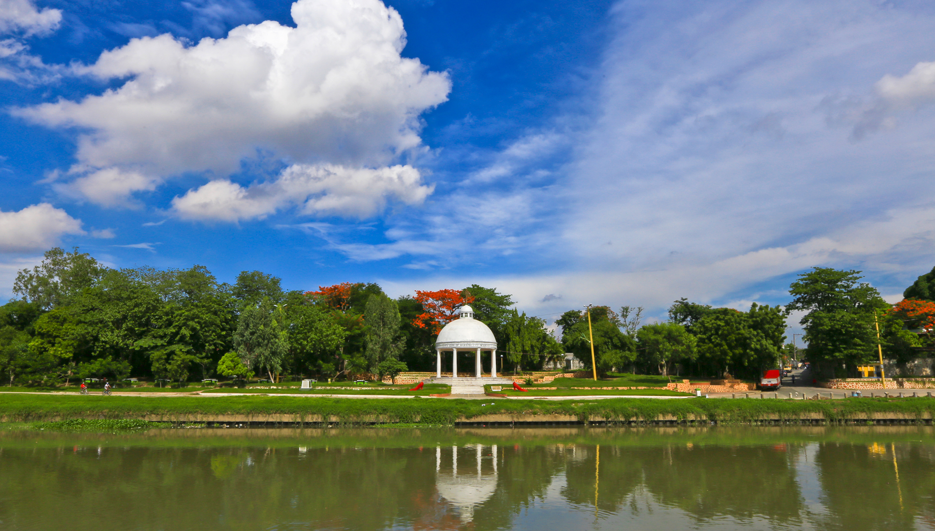
Roman Garden at Marikina River Park

The park, under development since 1993, is the city's biggest recreational and sports area containing the Riverbanks Center, a mall and office complex, and the biggest roller skating rink in the Philippines.  Marikina River Park is a popular area for camping, jogging, biking and other outdoor activities not just for Marikina residents but also for those from nearby cities in Metro Manila.

Marikina Riverbanks

Riverbanks Center

Riverbanks Center (also known as Marikina Riverbanks/Marikina Riverbanks Center or simply Riverbanks) is an integrated development complex for shopping, recreational, business and commercial along Andres Bonifacio Avenue adjacent to Marikina River in Barangka, Marikina, Metro Manila, Philippines.

marikina river park entrance fee marikina riverbanks park marikina riverbanks open hours marikina riverbanks mall marikina riverbanks shoes marikina riverbanks night market marikina riverbanks food park riverbanks mall stores
Riverbanks Center

It is home of the Philippine's biggest outdoor amphitheater and outlet center, and the location of once the world's largest pair of shoes.


WHERE TO STAY IN MARIKINA

Here's a list of hotel and accommodation in and nearby Marikina City:


IMPORTANT NOTE: The rates, contact details and other information indicated in this post are accurate from the time of writing but may change without IMFWJ's notice. Should you know the updated information, please leave a comment below.

 Image of Marikina River map Marikina River map Image of Marikina River drawing Marikina River drawing Feedback marikina river bank marikina river cctv live marikina river live marikina river park marikina river water level today marikina river location
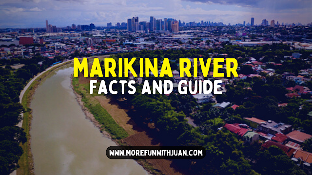
MARIKINA RIVER: History, Facts and Guide (Plus Attractions Nearby)

san rafael river adventure price san rafael river adventure rates 2022 san rafael river adventure review san rafael river adventure location san rafael river adventure rates 2021 san rafael river adventure map san rafael river adventure promo 2021 san rafael river adventure history

Welcome to the home of adventures in Bulacan!

Looking for a place to unwind and getaway from the busy city life? Just 2 hours away from Metro Manila, San Rafael River Adventure offers the most of different camping and resort activities in Bulacan.


GLAMOROUS CAMPING

The resort also offer Glamorous Camping - Glamping. Each of their regular glamping tents have its own bonfire beside the river.

private resorts in bulacan cheap private resort in bulacan nature resort in bulacan farm resort in bulacan bulacan private pool resort best resorts in bulacan bulacan resorts open private resort in malolos, bulacan
San Rafael River Adventure

You will definitely enjoy the scenery during the night and the sound made by the insects will surely be a music to your ears. Peacefulness and serenity will definitely be an experience when you try Glamping in San Rafael River Adventure.

ABOUT SAN RAFAEL RIVER ADVENTURE

San Rafael River Adventure Resort and Events Place lets you escape from the busy cities of Metro Manila and experience the perfect blend of recreation and relaxation.

San Rafael River Adventure offers a great venue for your unforgettable moments. They are located in an unexpected paradise within your reach which is just an hour drive from Balintawak Exit.

san rafael river adventure review  san rafael river adventure food menu  san rafael river adventure airbnb  san rafael river adventure address  san rafael river adventure activities  san rafael river adventure blog  san rafael river adventure contact number  san rafael river adventure wedding packages
San Rafael River Adventure

Experience simple luxury at its best. You can enjoy one-of-a-kind Glass Accommodations at San Rafael River Adventure! You don't have to travel abroad to experience staying in a very simple yet luxurious accommodation. Their Stilt Glass Cabin is one of the firsts accommodation of its kind in the Philippines!

At San Rafael River Adventure, you can experience different water adventures like:
  • Boating
  • Jet Skiing
  • Kayaking
  • Paddle Boarding
  • Banana Boating
  • Wake Boarding
  • Fishing while aboard the Kubo raft

Enjoy your stay by trying their water and land adventures that will surely make your visit very memorable and exciting. They offer all of these in just one place, no need to visit different resorts just to experience each adventure.

HOW TO GET TO SAN RAFAEL RIVER ADVENTURE

san rafael river adventure promo 2022 san rafael river adventure rates 2021 san rafael river adventure promo 2021 san rafael river adventure review san rafael resort san rafael river adventure activities san rafael river adventure contact number san rafael river adventure map

Please follow these directions to go to San Rafael River Adventure from Metro Manila:
  1. From NLEX Balintawak Toll Plaza to Balagtas Exit, continue straight to Bustos via Plaridel Bypass Rd. take a left turn at Gen. Alejo
  2. Follow the road to Bustos Municipal Hall then turn right going to Baliuag via Bustos bridge.
  3. Then turn right going to Brgy Talacsan via Baliuag San Rafael Rd.

If you don’t have a private vehicle, you can rent a car or van here.

For a detailed view of the Google Map below:


When commuting, simply ride a Baliwag Transit bus in Cubao en route to Baliuag Bulacan, then get off at the Baliuag terminal.

Rent a private tricycle to the resort. The travel time is about 1.5 – 2 hours depending on traffic. 

Or you can book a trip here:

Powered by 12Go system

RESORT AMENITIES AND THINGS TO DO

san rafael river adventure review  san rafael river adventure food menu  san rafael river adventure airbnb  san rafael river adventure address  san rafael river adventure activities  san rafael river adventure blog  san rafael river adventure contact number  san rafael river adventure wedding packages
San Rafael River Adventure

San Rafael River Adventure offers:
  • Air Conditioned Rooms
  • Glamping Tents Accommodations
  • Infinity Pool
  • Floating Pool
  • Children’s Pool
  • Slide and Blob
  • Wildlife
  • Parking
  • River Cruise
  • Ihaw-Ihaw Buffet
  • Editha’s Restaurant and Events Place

HOW TO BOOK A STAY AT SAN RAFAEL

You can use the following link to book a stay at San Rafael River Adventure:


For more details about each accommodation, please see the sample rates below:


  •  
  •  
  •  

  •  
  •  
  •  
  •  
  •  
  •  
  •  
  •  
  • Standard CHECK-IN and CHECK-OUT

    • Day Tour - 7:30am to 6:00pm
    • Night Tour - 7:30pm to 6:00am of the following day
    • Overnight - 7:30pm to 6:00pm of the following day

    Klook.com

    San Rafael River Adventure 

    Address: Barangay Talacsan, San Rafael, Bulacan, Philippines 3008
    Contact numbers:
    • (63) 995 974 6224 (Globe)
    • (63) 919 295 9899 (Smart)
    • (63) 917 924 4546 (Globe)
    • (63) 939 474 8876 (Smart)
    • (63) 906 026 7988 (Globe)

    Landline:
    +8 6681 372 | +8 6666 894 | +8 6666 210 | (044) 8 128 552 (Bulacan)
    Resort 24 Hour Hotline Number:
    (63) 917 924 4546 (Globe) | (63) 920 800 8341 (Smart)
    Email:
    corporate@sanrafaelriveradventure.com
    teambuilding@sanrafaelriveradventure.com

    Frequently Asked Questions (FAQs) About San Rafael River Adventure

    • Can I go to San Rafael River Adventure without a reservation? 
      Sadly, no. The resort is by reservation only. 

    • Which popular attractions are close to San Rafael River Adventure Camping?
      Nearby attractions include Big Rock Farm Resort (4.9 km), Amana Waterpark (7.6 km), and Galilee Mansion And Garden Resort (3.2 km).

    • What are some of the property amenities at San Rafael River Adventure Camping?
      Some of the more popular amenities offered include free breakfast, a pool, and free parking.

    • Can I bring food into San Rafael River Adventure? 
      Yes, bringing food is allowed. No corkage fee too! You can even cook using their griller (available upon request).

    • Is San Rafael River Adventure good for kids? 
      Yes absolutely! With the short distance from Metro Manila and the activities included in the place, kids will surely have a great time here.

    All photos are courtesy of San Rafael River Adventure 

    ALSO IN BULACAN


    IMPORTANT NOTE: The rates, contact details and other information indicated in this post are accurate from the time of writing but may change without IMFWJ's notice. Should you know the updated information, please leave your comment down below.

    IMFWJ IS NOW ON YOUTUBE!
    WHERE TO STAY IN BULACAN
    san rafael river adventure review  san rafael river adventure food menu  san rafael river adventure airbnb  san rafael river adventure address  san rafael river adventure activities  san rafael river adventure blog  san rafael river adventure contact number  san rafael river adventure wedding packages  private resorts in bulacan cheap private resort in bulacan nature resort in bulacan farm resort in bulacan bulacan private pool resort best resorts in bulacan bulacan resorts open private resort in malolos, bulacan

    BULACAN: Guide to San Rafael River Adventure (Glamping, Room Rates, Amenities and Activities)


    Just a stone’s throw away from the busy streets of Taipei lies a river that weaves through green mountains, indigenous villages, and healing hot springs—the Nanshi River (å—å‹¢ęŗŖ) in Wulai, New Taipei City.


    Flowing gently through the heart of the Atayal ancestral land, Nanshi River is not only a source of life and legend but also a scenic destination for nature lovers, families, and travelers in search of quiet beauty.

    Nanshi River in Wulai District

    In this article, we’ll take you on a slow, immersive journey along Nanshi River—sharing its natural features, cultural significance, and how it plays a central role in the Wulai experience.

    Visit my Ultimate Taiwan Travel Guide to know more about the country.

    Loading...

    What Is the Nanshi River?

    Nanshi River, also known as Nanshih Creek, is a major tributary of the Xindian River. It winds through Wulai District, carving valleys between lush green hills and supporting both wildlife and the long-standing Atayal indigenous community. The river is fed by clear mountain springs, making it one of the cleanest and most tranquil waterways in northern Taiwan.

    Nanshi River on map

    Its name “å—å‹¢ęŗŖ” translates to “Southern Force Creek,” hinting at both its flow direction and its life-sustaining power.


    Where to See Nanshi River in Wulai

    The most accessible and picturesque part of Nanshi River is in Wulai Old Street and the area around Wulai Waterfall.

    Wulai Waterfall

    • Wulai Riverside Walk – From the end of Wulai Old Street, a pedestrian path runs parallel to the river, offering breathtaking views and photo spots. The path is perfect for leisurely strolls, birdwatching, or simply sitting by the edge with your feet in the cool water.

    • Wulai Suspension Bridge – A short walk from the Old Street, this bright red bridge offers panoramic views of the river and the surrounding hills. It’s a great place to pause and take in the sights and sounds of the flowing stream below.

    • Hot Spring Spots – Along the riverbanks, you’ll find several hot spring resorts and even a few free outdoor pools (though many were restricted after 2023 due to safety regulations). These springs tap directly into geothermal sources near the river.

    • Wulai Waterfall Viewpoint – Further upriver, the Nanshi dramatically cascades down in the form of Wulai Waterfall, one of the tallest in northern Taiwan at 80 meters high. Here, the river transforms from a gentle stream to a powerful display of nature’s energy.

    Wulai Suspension Bridge over Nanshi River

    Things to Do Along Nanshi River


    1. Riverside Strolls & Nature Walks

    The riverside trail near Wulai Old Street is shaded, peaceful, and perfect for those looking to unwind or take photos of the blue-green water, rock formations, and surrounding jungle.


    2. River Wading or Foot Soaking

    In warmer months, visitors often wade into the river’s shallows for a refreshing soak. Just bring water shoes or sandals, and always be cautious of water levels.


    3. Visit the Hot Springs

    Many of the hot spring resorts sit right by the Nanshi River, offering private or public baths with river views. It’s a surreal experience—soaking in hot, mineral-rich water while listening to the sound of the flowing stream below.

    Call Me Garden Hotel Hot Spring in Wulai

    4. Sunset Viewing

    The way the light hits the river during golden hour is something special. The reflections off the water, the silhouette of the forested cliffs, and the soft mountain mist create a picture-perfect setting.


    5. Take a River Photo Walk

    If you're into photography, the contrasts between water, rocks, wooden bridges, and indigenous murals along the riverside provide a visual feast. Bring a camera or smartphone with portrait and landscape modes ready.


    Cultural Significance to the Atayal People

    For the Atayal tribe, one of Taiwan’s largest indigenous groups, Nanshi River isn’t just a waterway—it’s a spiritual and ancestral home. The river has supported agriculture, fishing, and community life for centuries. It is featured in local legends, ceremonies, and oral histories, and even today, many Atayal festivals and rituals happen close to the water.


    This connection to nature can still be felt when walking along the riverbanks, where you’ll spot totems, tribal symbols, and traditional patterns integrated into benches, bridges, and viewing decks.


    Best Time to Visit


    Spring (March–May) – Cherry blossoms along the riverside and cool weather make it ideal for long walks.

    Summer (June–August) – Great for river wading and family outings, but bring sun protection.

    Autumn (September–November) – Clear skies and golden foliage. A photographer’s dream.

    Winter (December–February) – Best season for hot springs by the river. Misty mornings and fewer crowds add to the magic.

    Langshen Bridge

    How to Get There


    From Taipei: Take the MRT to Xindian Station, then board Bus 849 to Wulai Terminal Station. The Nanshi River runs alongside the road as you enter Wulai, and you’ll cross it multiple times via bridges.

    By Car: Wulai is about a 1-hour drive from central Taipei. Scenic mountain roads and river views accompany you along the way.

    At Wulai Bus Station

    Tips for Visitors


    Bring comfortable shoes, especially if you plan to explore riverside trails.

    Pack insect repellent, especially in warmer months.

    Be mindful of river safety—do not swim after rain or in strong currents.

    Support local businesses: grab food, buy souvenirs, or book a room with river views.

    Visit my list of Frequently Asked Questions in Taiwan (FAQs) to learn more.

    A nice view of Nanshi River from a restaurant in Wulai Old Street

    Final Thoughts: A River That Refreshes the Soul

    The Nanshi River isn’t just a background scene—it’s the heartbeat of Wulai. Whether you’re sipping tea on a riverside bench, soaking in a natural spring, or reflecting by its flowing waters, the river has a calming power that makes you slow down and simply be present.

    For anyone visiting Wulai—whether for the Old Street, the log cart, or the waterfall—don’t overlook the quiet presence of this river. Spend time by it. Walk beside it. Let it tell you its story.

    Planning a trip to Wulai? Don’t miss our other guides on:


    NANSHI RIVER: A Serene Escape into Taiwan’s Mountain Wilderness in Wulai, New Taipei City