
Here's your guide before, during, and after an earthquake.
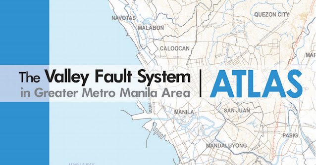
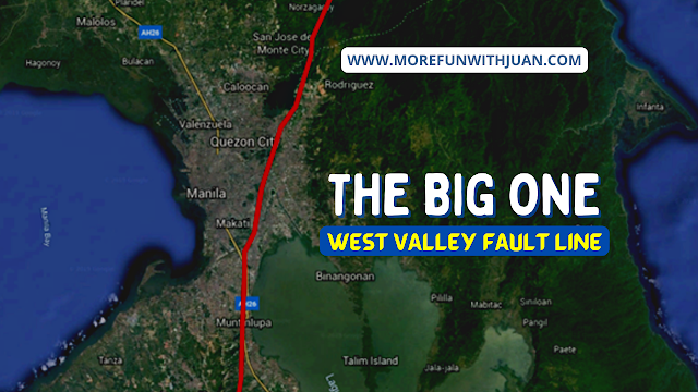
The Philippine Institute of Volcanology and Seismology (Phivolcs) has been urging the public to be prepared for earthquakes, considering that they are unpredictable and may strike anytime. Read: What dangers await when the West Valley Fault moves
Loading...
Before Earthquake
In an Earthquake Preparedness Guide on its website, Phivolcs lists the things one should do before, during and after an earthquake.
- Know the hazards. Familiarize yourself with earthquake hazards in your area.
- Know the EVACUATION AREA. Check the nearest route going to identified evacuation area.
- Prepare your house or workplace.
- Prepare an EMERGENCY SUPPLY KIT. Make it accessible at all times.
- Learn to use first aid kit, fire extinguishers, alarms, switching off waterlines, gas tanks and circuit breaker.
- Participate during DRILLS. Regularly practice the evacuation procedure.

EMERGENCY KIT AND ESSENTIALS
Here are the best options to shop for your emergency kit and life essentials:
Shopee is my go-to app for things I needed like the ones above. If you'd like discounts and vouchers, you may get the best offers here:

During Earthquake
During an earthquake, Phivolcs advises affected persons to stay indoors if they are already within a structurally sound building or home. In particular, the agency cites the following tips:- If possible, quickly open the door for exit
- Duck under a sturdy desk or table, and hold on to it, or protect your head with your arms
- Stay away from glass windows, shelves, cabinets, and other heavy objects
- Beware of falling objects. Be alert and keep your eyes open
Meanwhile, those who are outside should move to an open area, and follow these safety measures:
- Stay away from trees, power lines, posts, and concrete structures
- Move away from steep slopes which may be affected by landslides
- If near the shore and feeling an earthquake, especially a strong one, quickly move to higher grounds in anticipation of possible tsunamis

After Earthquake
Immediately after an earthquake, Phivolcs advises affected persons to take “the fastest and safest way out of the building.” One should not use elevators, enter damaged buildings, or use telephones unless necessary, the agency says.

Most of all, do not panic, according to Phivolcs.
Meanwhile, before an earthquake, the agency emphasizes planning. (See the rest of the Phivolcs infographic below)

ATTRACTIONS TO SEE IN MANILA
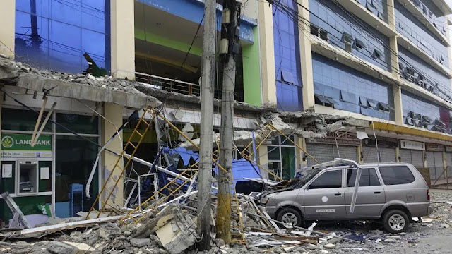
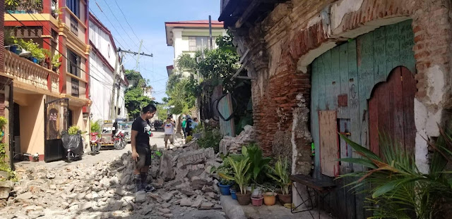
Klook.comA 2004 study conducted by the Japan International Cooperation Agency, the Metro Manila Earthquake Impact Reduction Study (MMEIRS), indicated that an earthquake hitting Metro Manila could destroy 40% of the buildings in the metropolis and kill about 34,000.
WHAT TO READ NEXT
- THE BIG ONE: What is West Valley Fault Line and What We Need to Do if it Happens
- Get the latest earthquake updates and volcanic activities from PHIVOLCS!
- List of Barangays in Metro & Greater Manila Areas near East and West Valley Fault Systems
- PHIVOLCS FaultFinder: What is it and How to Utilize it


.jpg)